Below is some information on many of the One-Room Schools that were located in Chanceford Township before 1950.
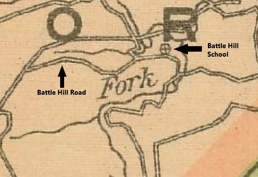
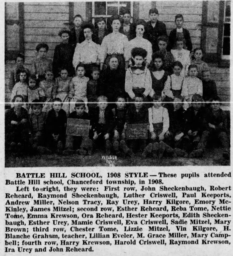
Battle Hill School
Battle Hill School was located along Battle Hill Road, to the east of the intersection with McKinley Road. It is believed the school got its name because of Indian battles which took place on this site. It was built on property purchased in 1857. The image below taken from the 1915 York County Public Road Map shows the school marked with a circle and a plus sign inside of it.
Bethel School
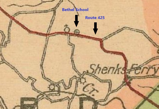
Bethel School was built on Route 425 beside Bethel Church, on land the school district bought in 1883. The school burned down in 1946, and the church picnic building was erected on the school property site. The image below taken from the 1915 York County Public Road Map shows the school marked with a circle and a plus sign inside of it.
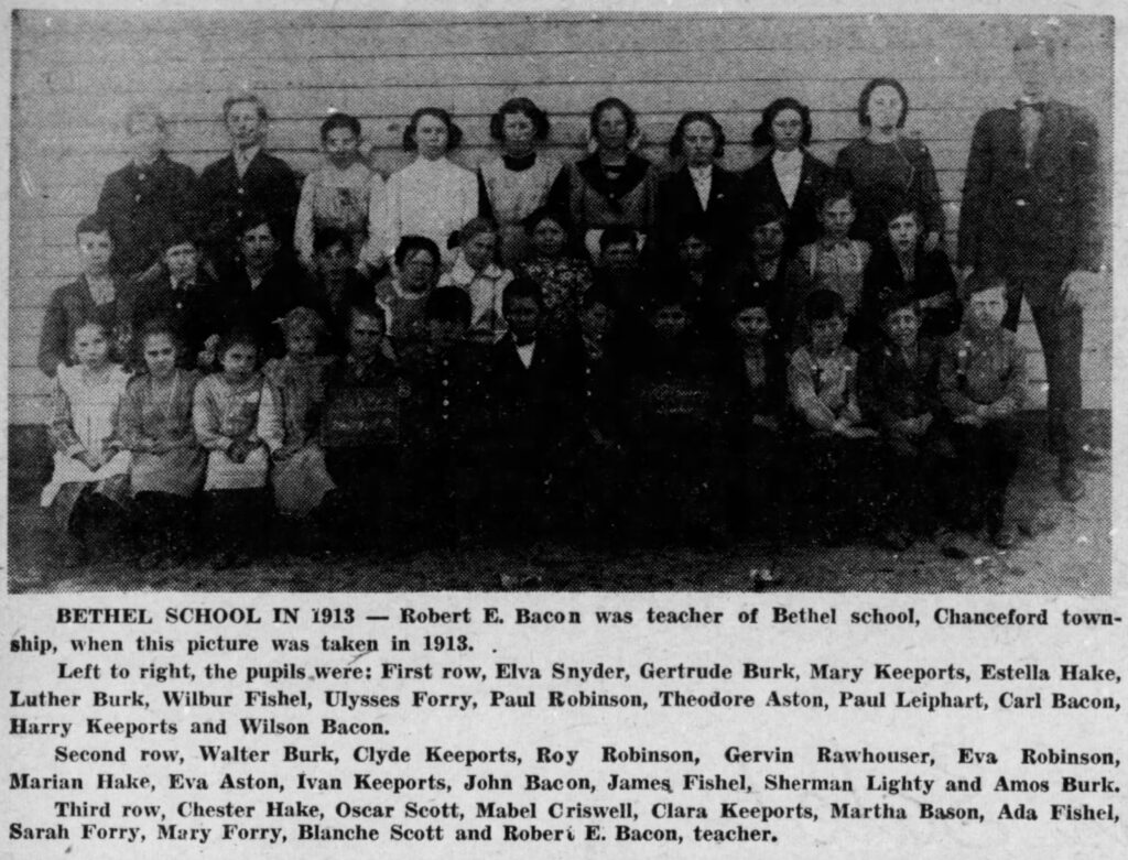
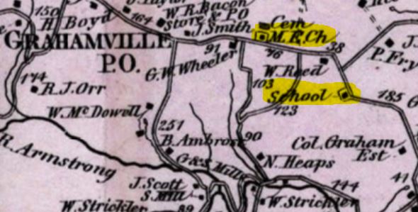
Before Bethel School was built, there was another school in the same area. The previous school was known as Graham School, and was built on land sold by Robert Graham to the school district in 1850. That school burned down in 1881. The image below shows the location of Graham School on the Beach Nichols 1876 Atlas of York County (highlighted in yellow). For reference, Bethel school was built where this map shows the M.E. Church to the northwest of Graham School (also highlighted in yellow).
Brogue School
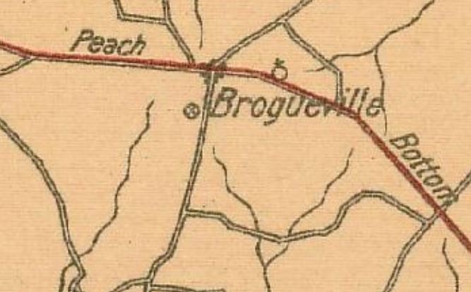
The school was built on property sold to the school district in 1850, it was part of the Brogue Hotel property. This served as the school until 1919 when a new 3 room school house was built nearby. These schools were located on property that is now owned by Mount Zion Baptist Church. The image below taken from the 1915 York County Public Road Map shows the school marked with a circle and a plus sign inside of it.
Clearview School
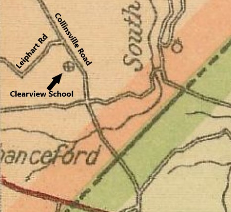
The property for this one-room school was sold to the school district in 1885 by George and Susan Wise. It was located along Collinsville Road and was in use as a school until the mid-1950’s. The image below taken from the 1915 York County Public Road Map shows the school marked with a circle and a plus sign inside of it.
Collinsville School
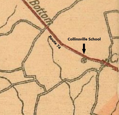
The property this school was built upon was sold to the school district in 1884, at that time the school was known as Mt. Airy School. A new school was built in 1924 and opened along Route 74, beside the Collinsville Drive-In and operated until 1958. This school is still standing and has been converted to a private residence. The image below taken from the 1915 York County Public Road Map shows the school marked with a circle and a plus sign inside of it.
Conrad School
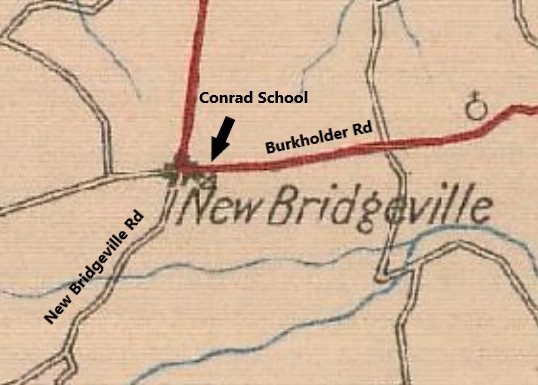
The school was built on property sold to the school district by Daniel Conrad in 1860. It operated as a school until it closed in 1958. The school was located on the southeast corner of Burkholder Road and New Bridgeville Road. The image below taken from the 1926 York County Public Road Map shows the school marked with a circle and a plus sign inside of it.
Dellinger School
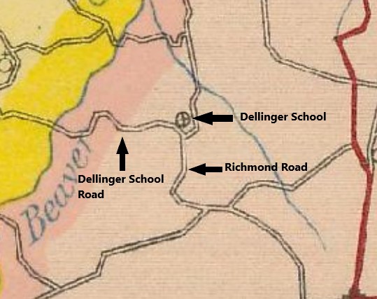
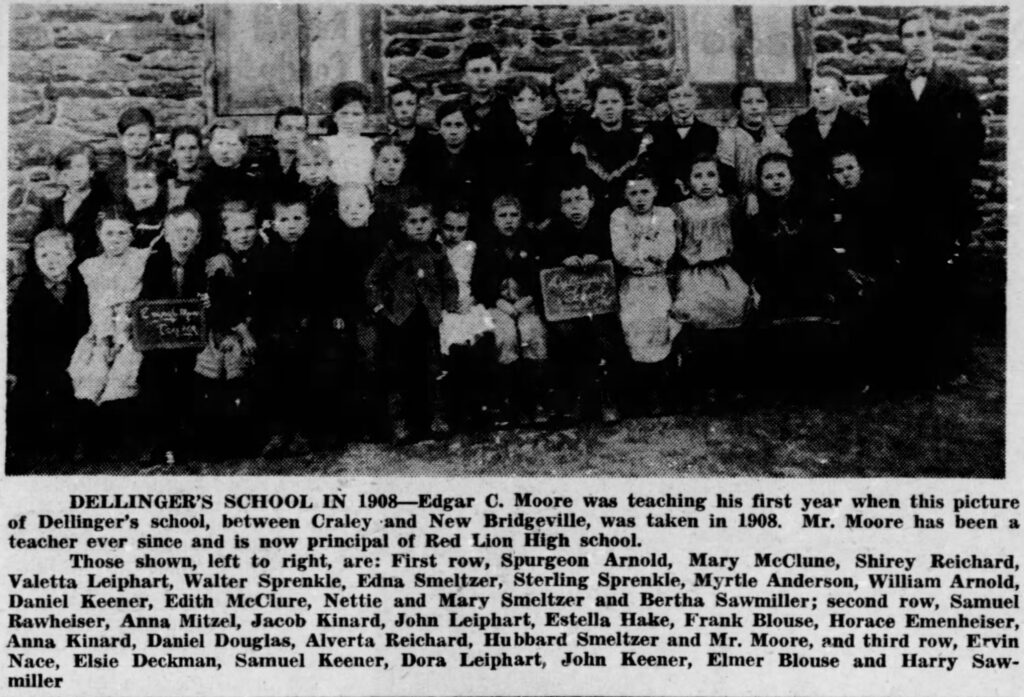
It is believed that Dellinger School was built in 1882 along Richmond Road. It served a school until it closed in 1958. The school house is now used as a private residence and is located at the northwest corner of Richmond Road and Dellinger School Road. As the below picture from 1908 mentions, Edgar C Moore, the famed Red Lion educator, started his education career at Dellinger School. The image below taken from the 1926 York County Public Road Map shows the school marked with a circle and a plus sign inside of it.
Gipe School
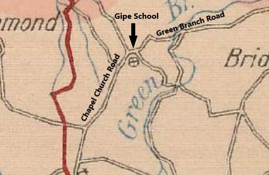
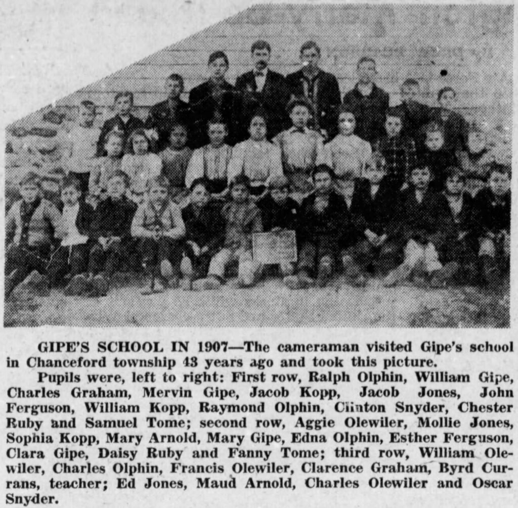
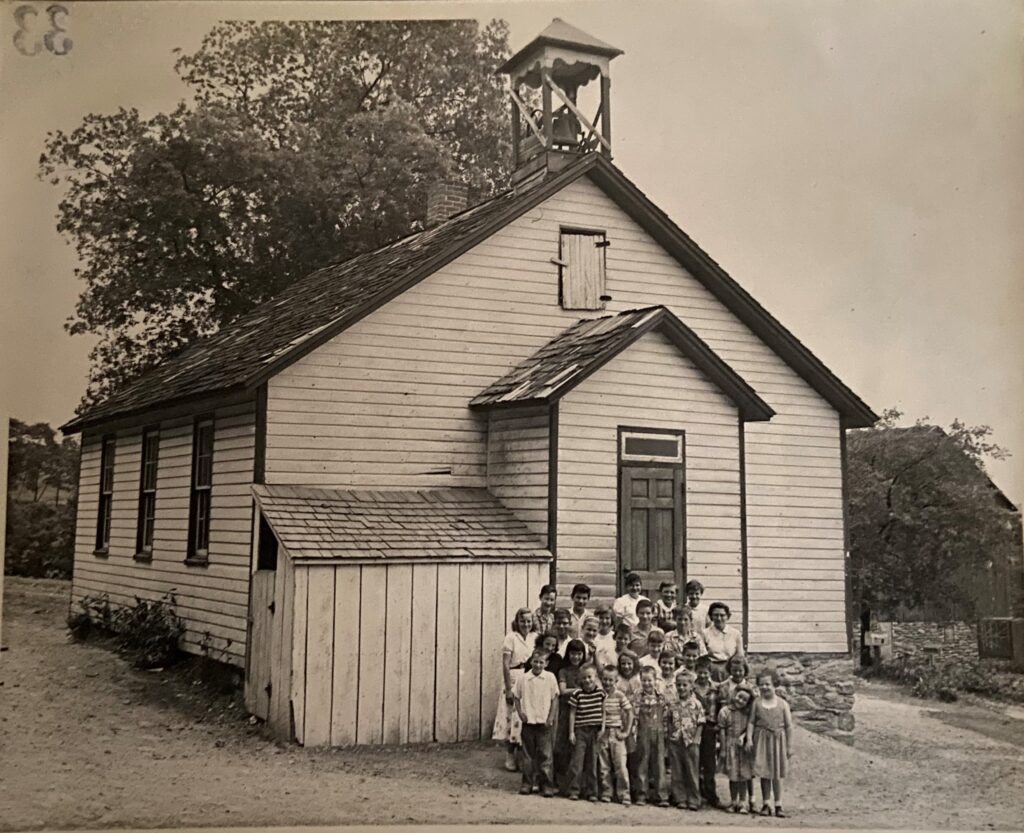
Gipe School was built upon land sold to the school district by Henry & Elizabeth Gipe in 1888. It served as a school until it closed in 1958. The school house is now used as a private residence and is located on the southeast corner of what is now the intersection of Green Branch Road and Chapel Church Road. The image below taken from the 1926 York County Public Road Map shows the school marked with a circle and a plus sign inside of it.
Glen Allen School
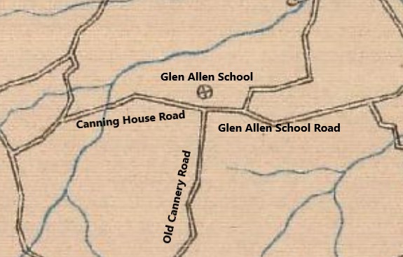
In 1886, Barbara and Michael Hake sold land to the school district for what was initially called Hake’s School, then later Glen Allen. It served as a school until it closed in 1958. The school house is now used as a private residence and is located on north of where Glen Allen School Road, Canning House Road and Old Cannery Road meet. The image below taken from the 1926 York County Public Road Map shows the school marked with a circle and a plus sign inside of it.
Guinston Allen School
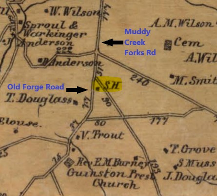
This school was built on property sold to the school district by George Blouse in 1835. It served as a school until it closed in 1958. The school was located at the “Y” at Old Forge Road and Muddy Creek Forks Road, it no longer is standing. The image below shows the location on Graham School on the Shearer 1860 Map of York County (highlighted in yellow).
Hickory Grove School
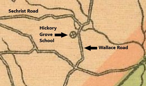
Hickory Grove School was located along Wallace Road, just to the south of the intersection with Sechrist Road. The date it opened is not known, however it closed as a school in 1927. The image below taken from the 1915 York County Public Road Map shows the school marked with a circle and a plus sign inside of it.
Miller School
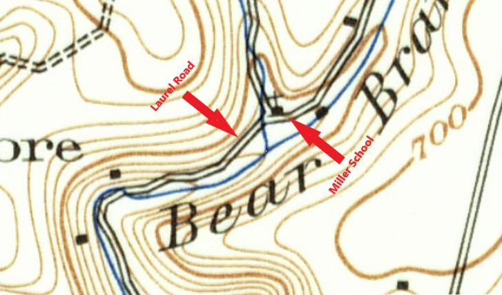
Miller School was located on Laurel Road, it was built on land donated by Philip Miller in 1881. The school closed in 1930. The image below taken from the 1908 USGS Topographical Map shows the school marked with an “x” above the mark for the building.
Saint James School
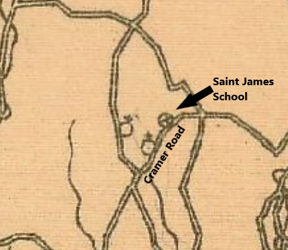
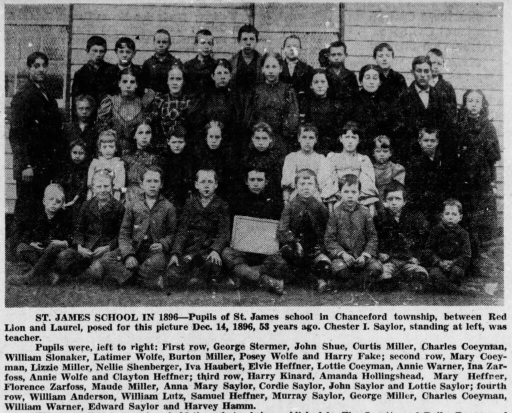
Saint James School was built about 1883 on property donated by Henry and Barbara Noss. It served as a school until 1958. The school was located right beside Saint James Church on Cramer Road. The image below taken from the 1915 York County Public Road Map shows the school marked with a circle and a plus sign inside of it.
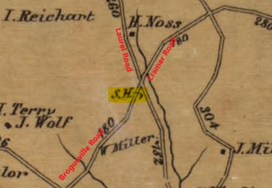
Before Saint James School was built, there was another school in this area called Sanney’s School. This school was built about 1855 on land sold by William & Catharina Miller. It was located at the intersection of Cramer Road, Brogueville Road and Laurel Road. The image below shows the location on Graham School on the Shearer 1860 Map of York County (highlighted in yellow).
Shaw School
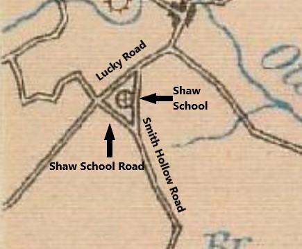
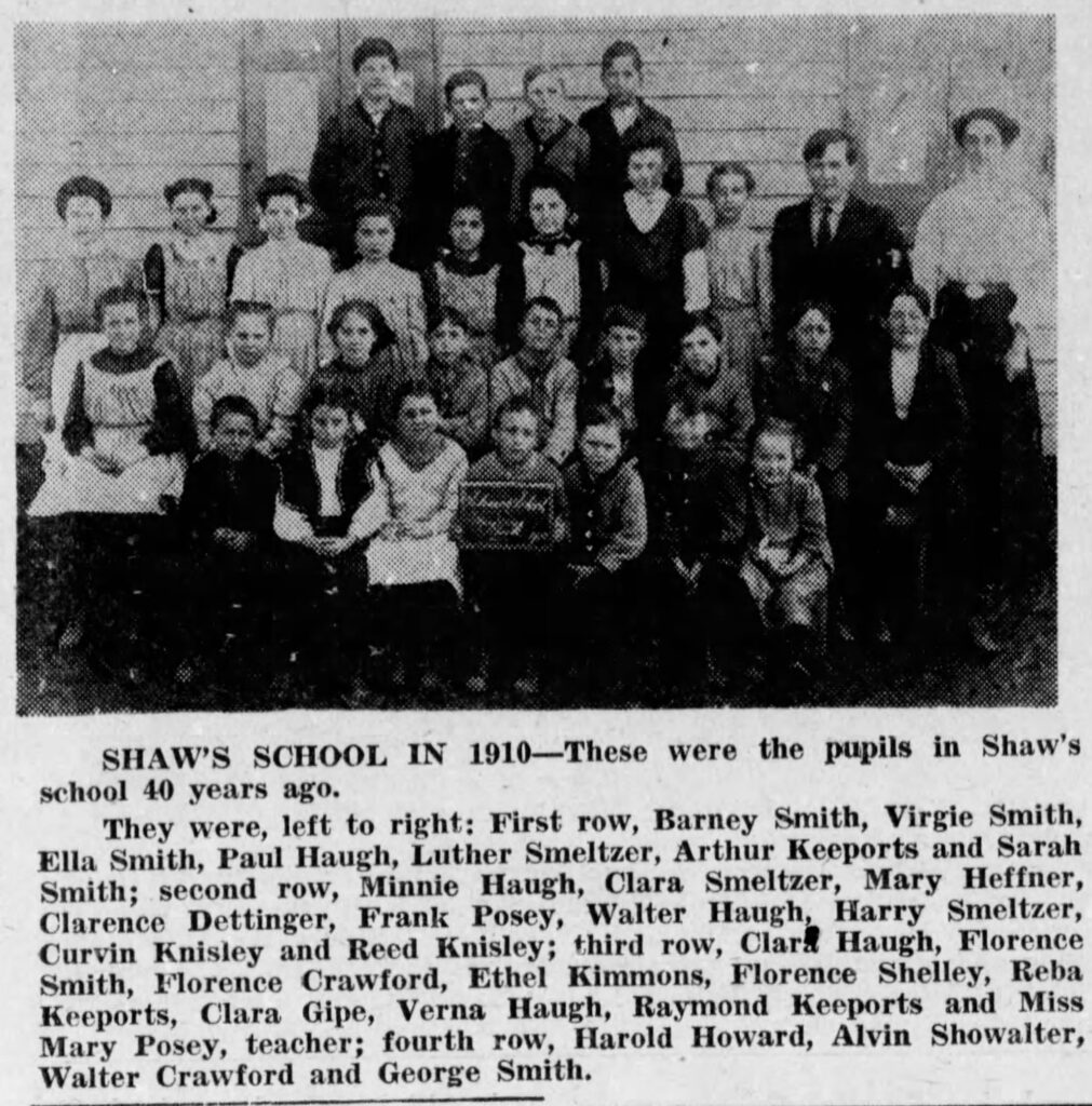
The school was built upon land purchased from Elizabeth Nichols in 1850 and it served as a school until 1958. The school was located along Shaw School Road, near Lucky Road and Smith Hollow Road. The image below taken from the 1926 York County Public Road Map shows the school marked with a circle and a plus sign inside of it.
Shenk’s Ferry School
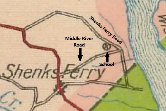
Shenk’s Ferry School was located along Shenk’s Ferry Road and Middle River Road. It was in existence by 1899, when it is mentioned in a newspaper article in the York Daily, and remained open until 1958. The image below taken from the 1926 York County Public Road Map shows the school marked with a circle and a plus sign inside of it.
Stony Lonesome School
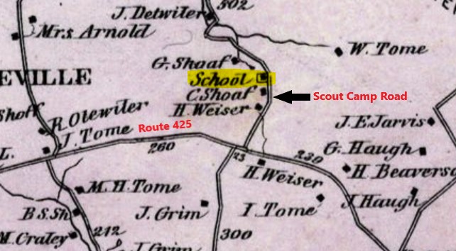
Stony Lonesome was built on land purchased from Anna & Eleanor Heuston in 1850. It served as a school until around 1915 or 1916, the land was sold by the school district in 1917 to Oliver Barbour when Weiser School was built just down the road. The school was located along Scout Camp Road, across from Wild Game Lane. The image below shows the location of Trinity School on the Beach Nichols 1876 Atlas of York County (highlighted in yellow).
Thompson School
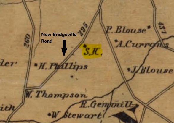
In 1850, Joseph & Robert Thompson sold land to the school district for the erection of the school and it remained open until 1958. The school is located along New Bridgeville Road. The image below shows the location on Graham School on the Shearer 1860 Map of York County (highlighted in yellow).
Trinity School
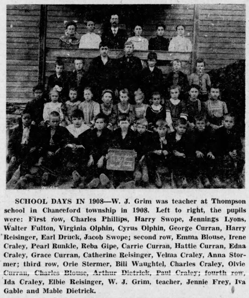
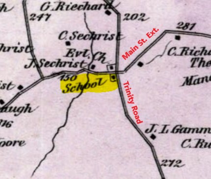
Trinity School was built on land sold to the school district in 1869 by John & Susan Sechrist. It is located on the southwest corner of Trinity Road and Main Street Ext. It remained a school until it closed in 1958, when it then became used as a HAM radio station by the Hilltop Transmitting Association. The image below shows the location of Trinity School on the Beach Nichols 1876 Atlas of York County (highlighted in yellow).
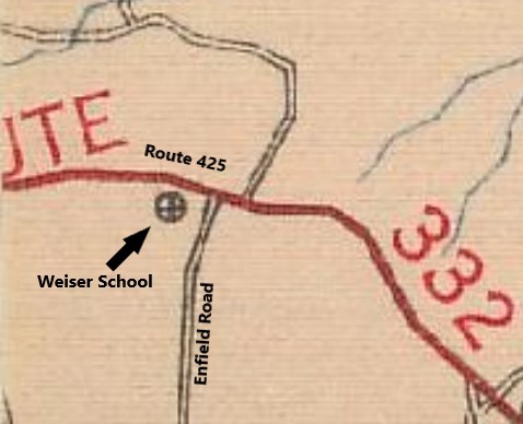
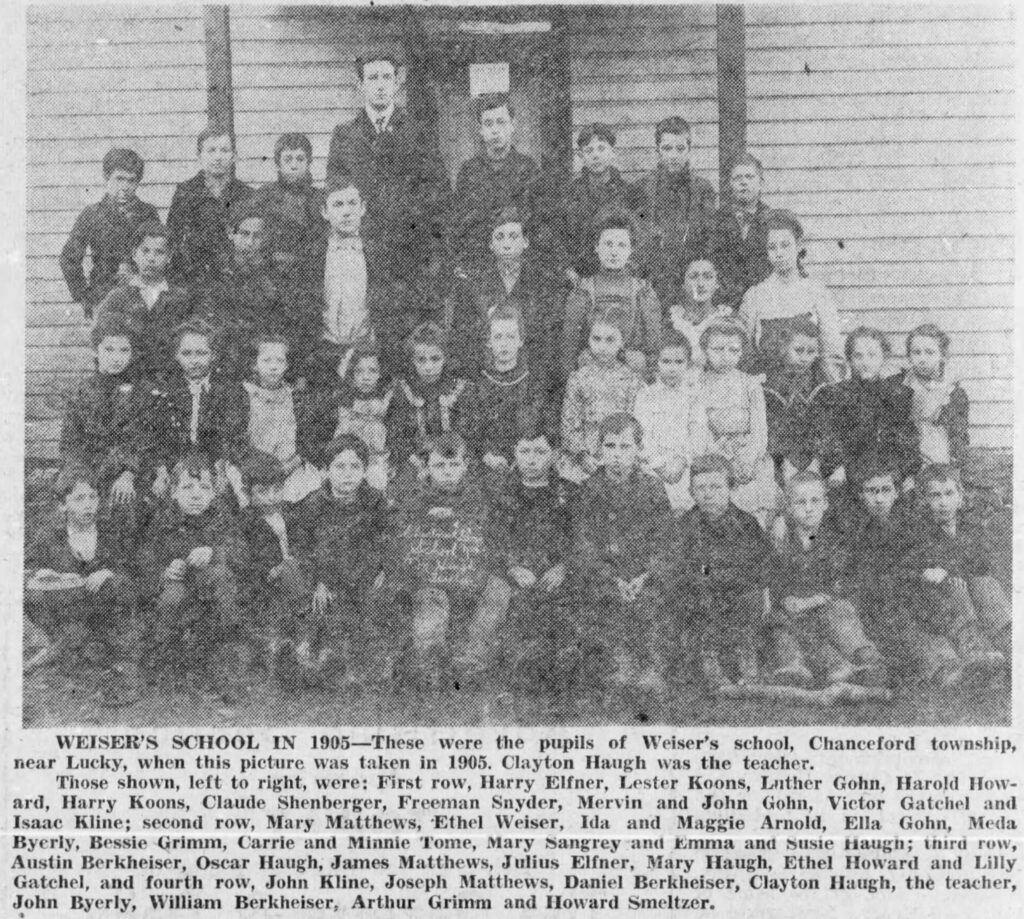
Weiser School
Weiser School was first established as a school in 1916 and remained open until 1958. The school was located along Route 425, east of New Bridgeville, near Enfield Road. The image below taken from the 1926 York County Public Road Map shows the school marked with a circle and a plus sign inside of it.
